

Quick answer
The distance from Sydney to Port Stephens ranges from 160 kilometres via the Pacific Motorway (M1) to Nelson Bay, to approximately 215 kilometres if you take the scenic coastal route through Newcastle. Most visitors cover the M1 route in 2 hours and 15 minutes to 2 hours and 45 minutes under normal traffic conditions, though Friday afternoon and Sunday evening traffic can add an hour or more to the journey.
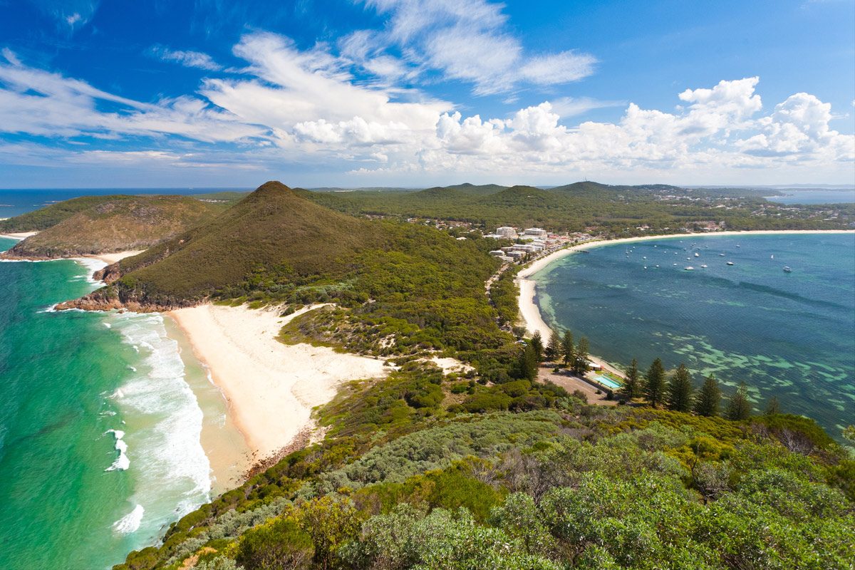
Port Stephens encompasses 26 beaches and a marine park twice the size of Sydney Harbour, yet many Sydney residents underestimate how much ground separates the two destinations. The straight-line distance measures roughly 145 kilometres, but road networks add considerable length depending on whether you prioritise speed or scenery. The M1 Pacific Motorway offers the fastest connection, cutting inland through Wahroonga, Hornsby, and the Central Coast before rejoining the coast near Newcastle. From there, drivers merge onto the Pacific Highway and branch east toward Nelson Bay, the main hub within Port Stephens. This route minimises turns and traffic lights, making it the default choice for same-day returns. Fuel stops cluster around Wahroonga, Morisset, and Hexham, with the last reliable services before Nelson Bay appearing near Raymond Terrace. The coastal alternative threads through Newcastle's urban core, adding 50-60 kilometres but rewarding drivers with harbour views, heritage architecture, and access to Stockton Beach. This route suits travellers combining Port Stephens with a Newcastle stopover or those willing to sacrifice 40-60 minutes for varied scenery. Weekend traffic through Newcastle's café precincts and beachfront roads slows progress, particularly between 11:00 and 14:00 when locals fill parking along The Strand and Nobby's Beach. Departure timing shapes the journey more than route selection. Leaving Sydney between 06:00 and 08:00 avoids the worst of the morning peak, though northbound M1 congestion persists near Wahroonga until 09:30 on weekdays. Southbound returns face heavier delays, especially Sunday afternoons when Central Coast day-trippers merge with Port Stephens visitors on the M1 south of Morisset. The stretch between Tuggerah and Wahroonga regularly slows to 60 km/h between 15:00 and 18:00 on Sundays and public holiday Mondays. Fuel economy and rest stops matter on a drive of this length. The M1 route consumes approximately 16-20 litres of petrol in a mid-sized sedan, with diesel vehicles averaging slightly less. Rest areas appear at Calga and Heatherbrae, both offering toilets and picnic facilities but no food services. Drivers towing boats or caravans should budget an extra 20-30 minutes due to reduced highway speeds and the need for wider turning arcs on Port Stephens' narrower coastal roads approaching Shoal Bay and Fingal Bay.
“The straight-line distance measures roughly 145 kilometres, but road networks add considerable length depending on whether you prioritise speed or scenery.”
Traveling the Distance From Sydney to Port Stephens by Car and Transit
Port Stephens is located approximately 160 to 200 kilometers north of Sydney. Driving via the M1 Pacific Motorway is the most direct method to reach the region.
M1 Pacific Motorway and Nelson Bay Road
Coach services from Central Station to Port Stephens
NSW TrainLink to Hamilton Station followed by connecting bus
The Best Time to Travel the Distance From Sydney to Port Stephens
The best arrival window for your trip is 06:00–10:00 to avoid mid-day heat and peak traffic congestion on routes from Sydney. Planning your departure to align with this window ensures a smoother journey and more time to explore the region.
Summer (Dec–Feb)
High; peak holiday seasonWarm, 18°C to 28°C; high humidity. These months see the largest number of visitors due to school holidays.
Autumn (Mar–May)
Moderate; quieter than summerMild, 13°C to 23°C. Stable conditions make this an ideal time for outdoor activities.
Winter (Jun–Aug)
Low; very peacefulCool, 8°C to 18°C. Lower visitor numbers provide more space at local attractions.
Spring (Sep–Nov)
Moderate; rising activityWarm, 12°C to 24°C. The weather is comfortable for coastal exploration before the summer rush.
Verdict: The best slot is a weekday arrival between 06:00 and 10:00 during the shoulder months of April or October.
Operating Hours for Planning Your Distance From Sydney to Port Stephens Trip
Port Stephens is a public region accessible to visitors at all times throughout the week. The area remains open daily to accommodate travel planning.
| Monday | 00:00–23:59 | |
|---|---|---|
| Tuesday | 00:00–23:59 | |
| Wednesday | 00:00–23:59 | |
| Thursday | 00:00–23:59 | |
| Friday | 00:00–23:59 | |
| Saturday | 00:00–23:59 | |
| Sunday | 00:00–23:59 |
Entrance Fees for the Distance From Sydney to Port Stephens
Port Stephens is a public region accessible to all visitors without a general entrance fee. Certain attractions, tours, or specialized activities within the area may require individual admission payments.
The base cost to enter the region is 0 AUD, with total spending dependent on the specific attractions or activities chosen.
Sights Near the Distance From Sydney to Port Stephens Route
The route from Sydney to Port Stephens passes several regional hubs that offer opportunities to break up the drive. Stopping at these locations allows travelers to experience the coastal landscape of New South Wales beyond the primary destination.
The Entrance
Located on the Central Coast, this area provides a convenient midpoint for a coastal break before continuing north toward Port Stephens.
Newcastle
As a major regional city, Newcastle offers accessible waterfront paths and heritage architecture that complement a longer journey.
Nelson Bay
Situated within the Port Stephens region, this primary hub serves as a central point for water-based activities and local dining once you complete the drive.
Myall Lakes National Park
Positioned just north of the region, these protected waterways offer a quieter alternative for those looking to extend their coastal exploration.
Check availability
Frequently asked questions about distance from sydney to port stephens
Everything you need to know about distance from sydney to port stephens